
When a Medieval Monk Crowdsourced the Most Accurate Map of the World, Creating “the Google Earth of the 1450s”
If we want to know the precise geographical location of, say, a particular church in Madrid, video arcade in Tokyo or coffee shop in Addis Ababa, we can figure it out in a matter of seconds. This is, in historical terms, a recent development indeed: many of us remember when the most detailed cartographical information we could get about distant lands (or for that matter, most of our own land) revealed to us only its cities and major roads — assuming we even had a world atlas at hand. Now, younger people take for granted the knowledge of not just where every place in the world is, but what it looks like, what its prices are, and what its visitors have said about it.
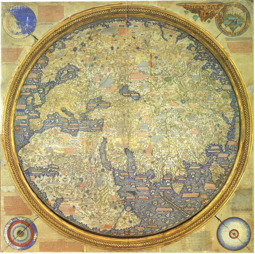
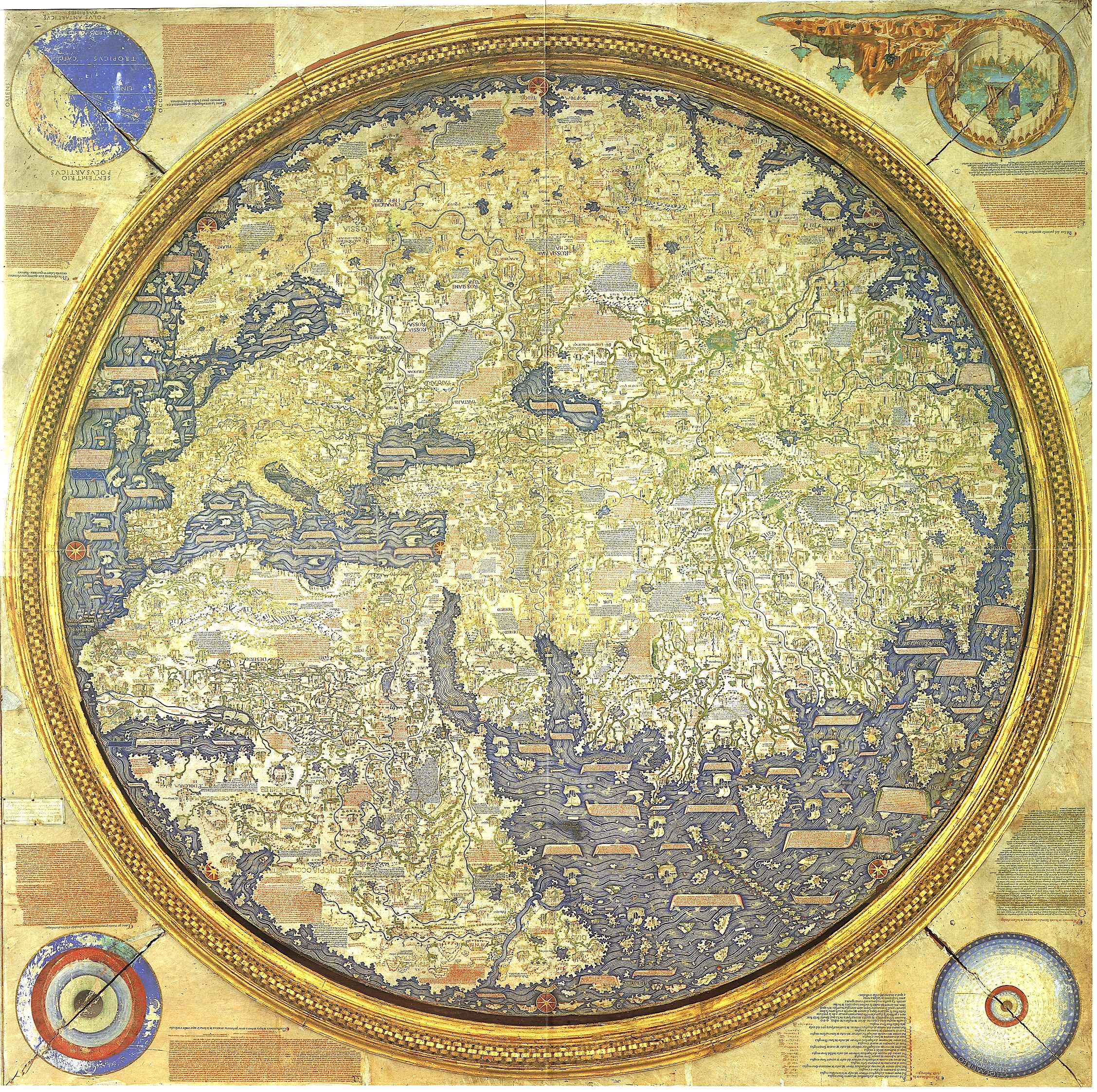
We live today, in other words, in the dream of Fra Mauro, the Venetian cartographer-monk of the late Middle Ages who created the most detailed and accurate world map to that point in human history. “As a young man, Fra Mauro had been a soldier and merchant of the famed Venice Merchant Fleet,” says the site of New World Cartographic. “His travels with the fleet around the Mediterranean and the Middle East resulted in his becoming interested in mapping, and he eventually settled in the monastery of San Michelle on the island of Murano, in the Venice Lagoon, where he became a lay brother.” In the early 1450s, “he was commissioned by King Afonso V of Portugal to create a map of the world.”
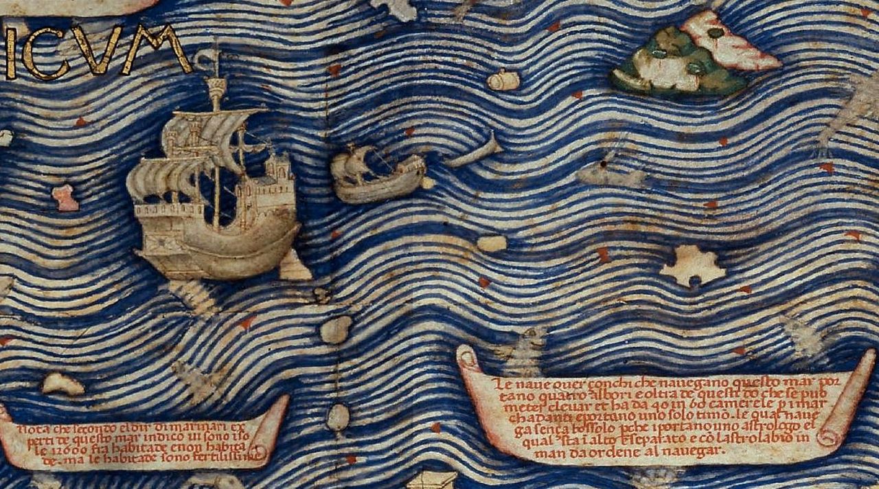
Portugal’s will to dominate world trade, which required the most detailed maps possible, was matched by Fra Mauro’s will to gather information about every corner of Earth, no matter how far-flung. And he could do that without leaving Venice: as Atlas Obscura’s Adam Kessler writes, “Arab traders and world explorers passed through the port, giving Fra Mauro an incomparable source of gossip and tall tales about the world. The fall of Constantinople, occurring a few years before the map was finished, would also have provided a rich source of well-traveled refugees, presumably willing to swap their stories for some bread or beer.” Not only did the map’s physical creation require a team of collaborators, the gathering of its contents relied upon the fifteenth-century equivalent of crowdsourcing.
This chapter of cartographical history invites such technological analogies: Kessler calls Fra Mauro’s completed mappa mundi “the Google Earth of the 1450s.” Despite his religious affiliation with the monastery of San Michele, Fra Mauro’s efforts produced an unprecedentedly radical rendition of the world. Breaking with religious tradition, he didn’t put Jerusalem in the center; “the Garden of Eden was relegated to a sidebox, not shown in a real geographic location.” His scrupulousness made him the first cartographer “to depict Japan as an island, and the first European to show that you could sail all the way around Africa.” While his map was “the most accurate ever made at the time,” its more than 3,000 annotations do contain plenty of tall tales, often of literal giants. But are they really much less trustworthy than the average twenty-first-century user review?
Related Content:
Explore the Hereford Mappa Mundi, the Largest Medieval Map Still in Existence (Circa 1300)
Europe’s Oldest Map: Discover the Saint-Bélec Slab (Circa 2150–1600 BCE)
Based in Seoul, Colin Marshall writes and broadcasts on cities, language, and culture. His projects include the Substack newsletter Books on Cities, the book The Stateless City: a Walk through 21st-Century Los Angeles and the video series The City in Cinema. Follow him on Twitter at @colinmarshall or on Facebook.