

Pangea to the Present to the Future: Watch Animations Showing 500 Million Years of Continental Drift
Things change…
Especially when you’re tracking the continental movement from Pangea to the present day in 5 million years increments at the rate of 2.5 million years per second.
Wherever you are, 350 million years ago, your address would’ve been located on the mega-continent of Pangea.
Early humans debuted around 200 million years ago, which is when the geospatial tech company ESRI’s time lapse animation, above, begins.
Here’s a map of what things looked like back then.

Those who’ve grown a bit fuzzy on their geography may require some indications of where future landmasses formed when Pangea broke apart. Your map apps can’t help you here.
The first split occurred in the middle of the Jurassic period, resulting in two hemispheres, Laurasia to the north and Gondwana.
As the project’s story map notes, 175 million years ago Africa and South America already bore a resemblance to their modern day configurations.
North America, Asia, and Europe needed to stay in the oven a bit longer, their familiar shapes beginning to emerge between 150 and 120 million years ago.
India peeled off from its “mother” continent of Gondwana some 100 million years ago.
Its tectonic plate collided with the Eurasian Plate, giving rise to the Himalayas and the Tibetan Plateau, by which point, dinosaurs had been extinct for about 15 million years…)
Geography nerds may chafe at the seemingly inaccurate sizes of Greenland, Antarctica and Australia. Rest assured that the mapmakers are aware, chalking it to the “distortion of the cartographic projection that exaggerates areas close to the Poles.”
Just for fun, let’s run it backwards!
But enough of the past. What of the future?
Those who really want to know could jump ahead to the end of the story map to see PALEOMAP Project founder Christopher Scotese’s speculative configuration of earth 250 million years hence, should current tectonic plate motion trends continue.
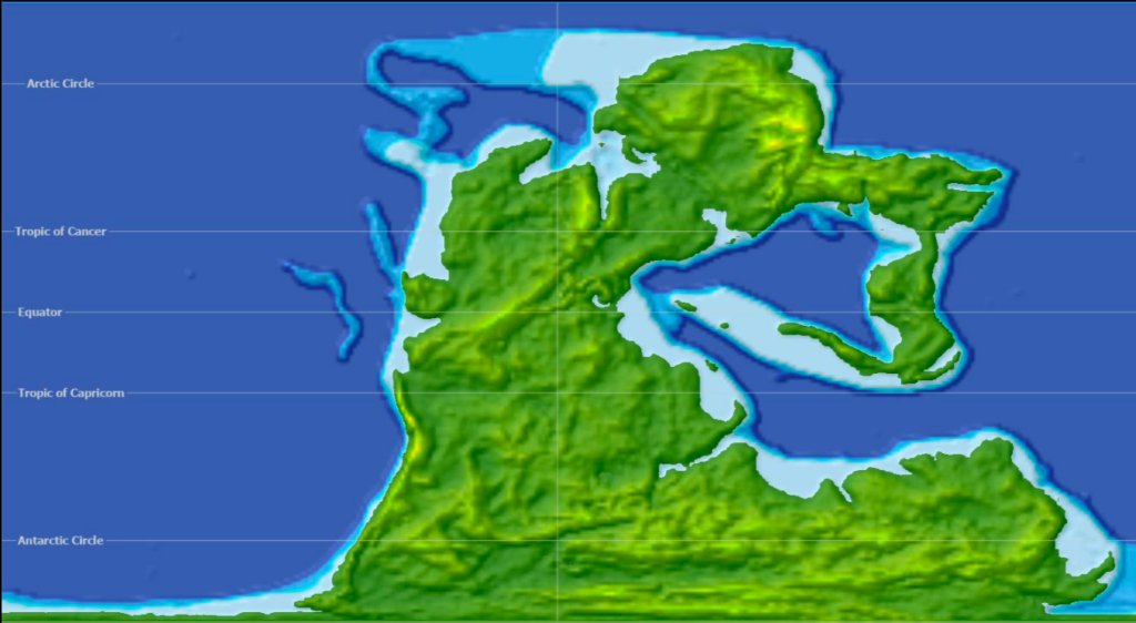
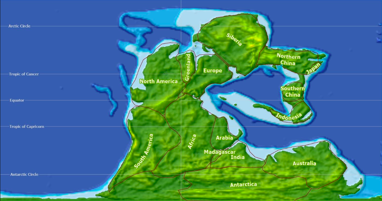
Behold his vision of mega-continent, Pangea Proxima, a landmass “formed from all current continents, with an apparent exception of New Zealand, which remains a bit on the side:”
On the opposite side of the world, North America is trying to fit to Africa, but it seems like it does not have the right shape. It will probably need more time…
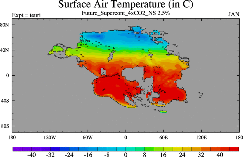
Not to bum you out, but a more recent study paints a grimmer picture of a coming supercontinent, Pangea Ultima, when extreme temperatures have rendered just 8 percent of Earth’s surface hospitable to mammals, should they survive at all.
As the study’s co-author, climatologist Alexander Farnsworth, told Nature News, humans might do well to get “off this planet and find somewhere more habitable.”
Related Content
Map Showing Where Today’s Countries Would Be Located on Pangea
– Ayun Halliday is the Chief Primatologist of the East Village Inky zine and author, most recently, of Creative, Not Famous: The Small Potato Manifesto and Creative, Not Famous Activity Book. Follow her @AyunHalliday.
