
Oculi Mundi: A Beautiful Online Archive of 130 Ancient Maps, Atlases & Globes

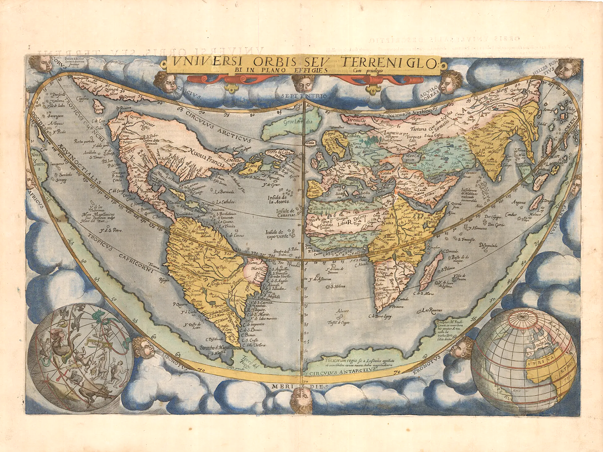
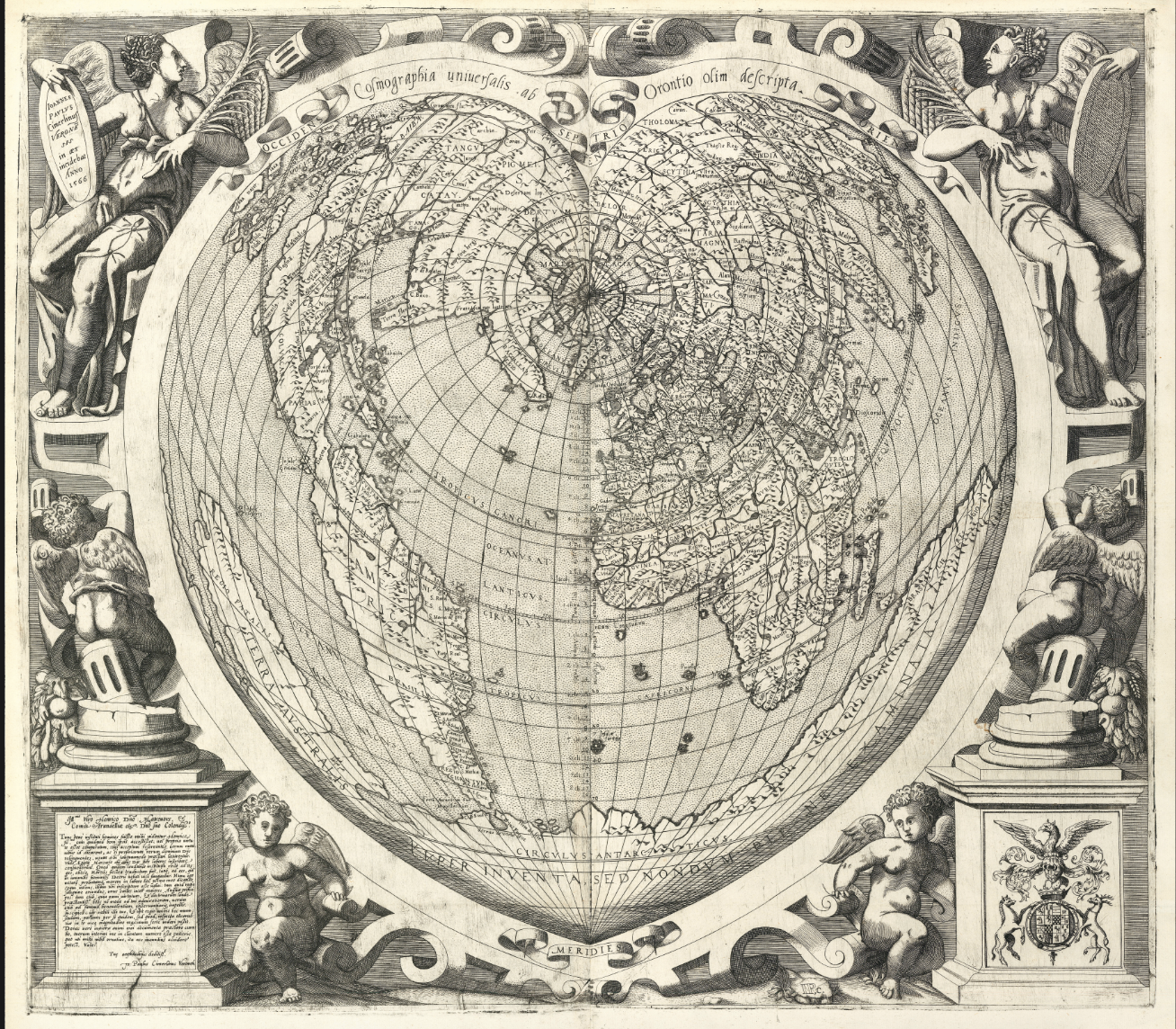
When it comes to maps, your first hit is always free. For you, maybe it was a Mercator projection of the world hung on the wall of an elementary-school classroom; maybe it was a road atlas in the glove box of your parents’ car. For Neil Sunderland, the earliest cartographic high seems to have come in childhood, from a humble map of Lancashire. When he found success in finance, his addiction grew in proportion to his means, and today his multi-million-dollar map collection includes the work of renowned sixteenth-century artists like Albrecht Dürer, Hans Holbein, and Giovanni Cimerlino, who in 1566 depicted the known world in the shape of a heart.
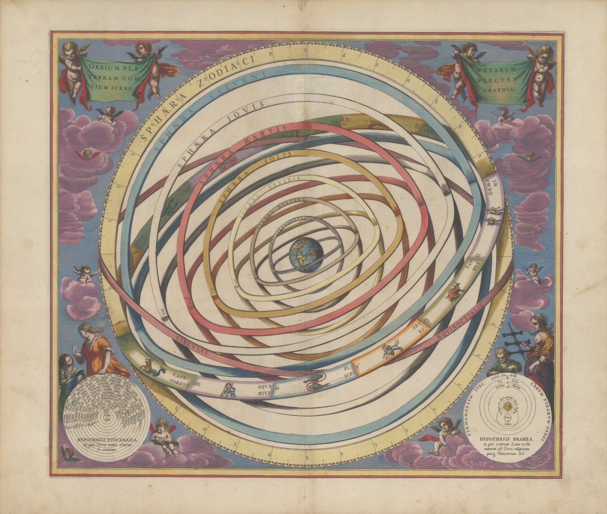
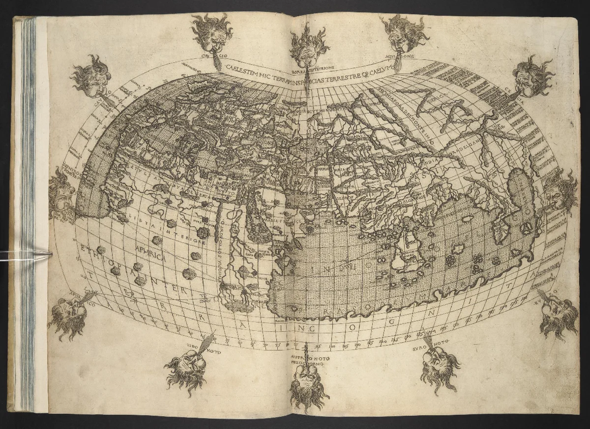
Cimerlino’s cordiform Earth (bottom) is just one of the 130 historic “world maps, celestial maps, atlases, books of knowledge and globes” now available for your perusal at Oculi Mundi, an elaborate web site with the digitized holdings of the Sunderland Collection. “A platform to explore high-resolution images of these beautiful objects, to peek inside the books, and to discover information and stories,” it offers both a chronologically ordered “research” mode and a more free-form “explore” mode for browsing.
Either way, with its oldest artifact dating to the early thirteenth century and its newest to the early nineteenth, it contains a great swath of cartographic history to behold.
The New York Times‘ Susanne Fowler quotes Sunderland’s daughter Helen Sunderland-Cohen, who oversees the Oculi Mundi project, describing a particularly venerable atlas by fifteenth-century humanist scholar Francesco Berlinghieri as “one of the earliest uses of copper plate, in atlases and in print. You can see how finely engraved the lines are, and how they’re learning to use copper plate.” All art may be inseparable from the state of technology of its time, but maps — the makers of which have always been driven to visualize and organize as much knowledge of the world as possible — reflect it with a special clarity.
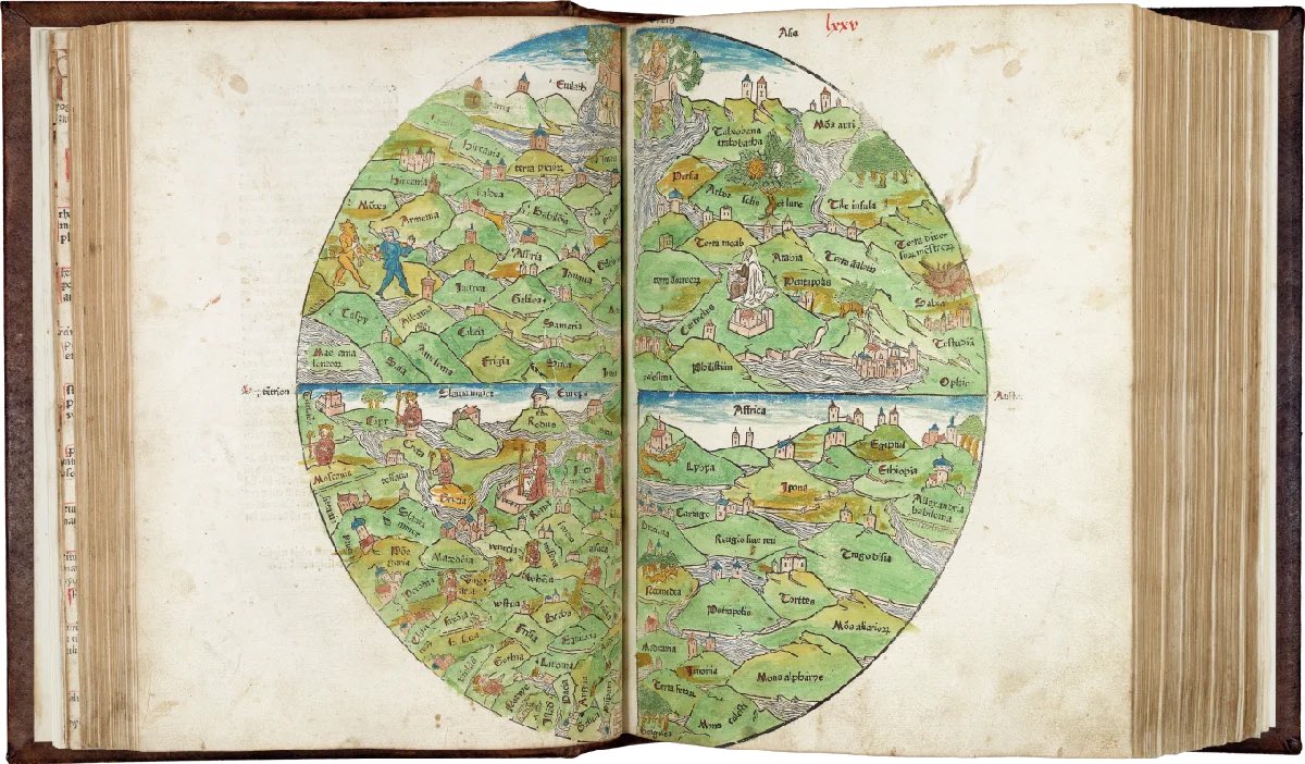
Exploring the Sunderland Collection through Oculi Mundi, you can also trace changes in what sort of knowledge belongs on maps in the first place. Sunderland-Cohen names as a personal favorite the “Rudimentum Novitiorum” from 1475 (above), “an illustrated chronicle in Latin used by monks as a teaching aid for novices.” Besides maps, it includes “Biblical history that is illustrated with lots of wonderful woodblock drawings, and everybody’s wearing clothing of the day, and in the houses of the day”; the connoisseur will notice techniques imported from illuminated manuscripts. As for what such a work costs today, well, if you have to ask, you’re not fully hooked on maps yet. Enter Oculi Mundi here.
Related content:
40,000 Early Modern Maps Are Now Freely Available Online (Courtesy of the British Library)
Download 91,000 Historic Maps from the Massive David Rumsey Map Collection
How Did Cartographers Create World Maps before Airplanes and Satellites? An Introduction
Based in Seoul, Colin Marshall writes and broadcasts on cities, language, and culture. His projects include the Substack newsletter Books on Cities, the book The Stateless City: a Walk through 21st-Century Los Angeles and the video series The City in Cinema. Follow him on Twitter at @colinmarshall or on Facebook.